Mapa de los caminos del departamento de Piura
| dc.contributor.author | Hoyos Salazar, Luis | |
| dc.date.accessioned | 2020-10-29T15:43:12Z | |
| dc.date.available | 2020-10-29T15:43:12Z | |
| dc.date.issued | 1928 | |
| dc.identifier.uri | http://repositorio.pucp.edu.pe/index/handle/123456789/172805 | es_ES |
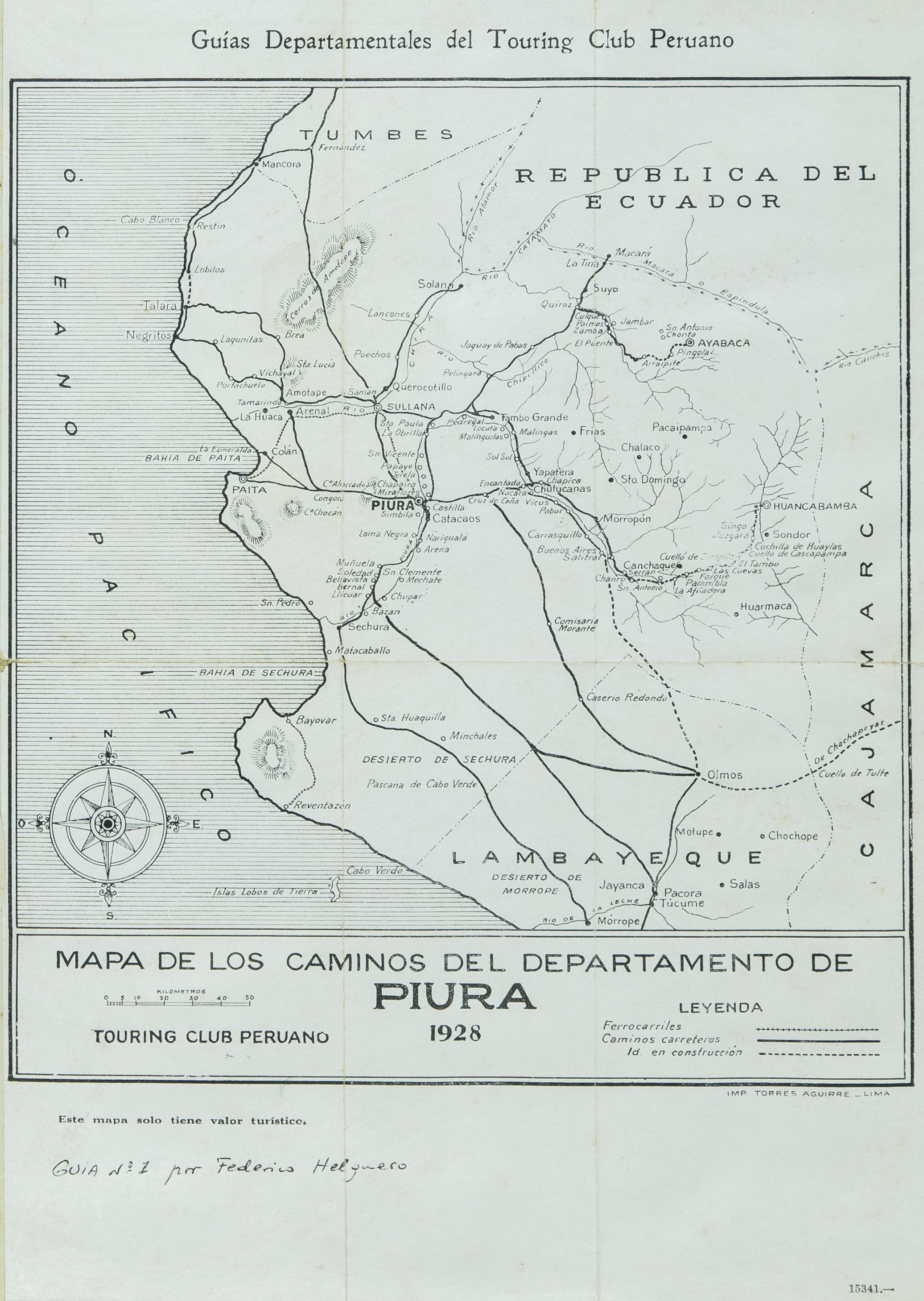
| dc.description | 1 mapa: byn Escala 1:500,000 | es_ES |
| dc.description.abstract | Mapa vial del departamento de Piura, [elaborado por el dibujante Luis Hoyos Salazar], a solicitud del Touring Club Peruano. El mapa muestra la red de caminos carreteros y ferrocarriles del departamento de Piura. El mapa fue publicado en el libro de Federico Helguero titulado Guías Departamentales (Lima, Imprenta Torres Aguirre, 1928). | es_ES |
| dc.language.iso | spa | |
| dc.publisher | Pontificia Universidad Católica del Perú. Sistema de Bibliotecas | es_ES |
| dc.rights | info:eu-repo/semantics/openAccess | es_ES |
| dc.rights.uri | http://creativecommons.org/licenses/by-nc-nd/2.5/pe/ | es_ES |
| dc.subject | Caminos – Perú – Piura – Siglo XX | es_ES |
| dc.subject | Touring y Automóvil Club del Perú | es_ES |
| dc.title | Mapa de los caminos del departamento de Piura | es_ES |
| dc.type | info:eu-repo/semantics/other | |
| dc.type.other | Mapa | |
| dc.subject.ocde | https://purl.org/pe-repo/ocde/ford#5.07.00 | |
| dc.publisher.country | PE |
Files in this item
This item appears in the following Collection(s)

Except where otherwise noted, this item's license is described as info:eu-repo/semantics/openAccess